

Mining
Our drones provide unparalleled high-resolution imagery that optimizes visual and three-dimensional operational processes. By harnessing the power of drones, we enable rapid and cost-effective survey solutions that enable monitoring, inspections and allow for real-time detection of potential hazards and enhanced safety protocols. Through seamless integration of drones into mining operations, we deliver heightened efficiency, substantial cost savings, and elevated environmental stewardship..

Monthly Pit Surveys
Monitor and Reconcile Depletion: Stay ahead with real-time monitoring of pit depletion.
Satisfy 3D Modelling Requirements: We provide centimeter accurate digital elevation models for engineering and geological requirements.
Update of Mine Statutory Plans: Ensure compliance effortlessly with regularly updated statutory mine plans.

Stockpile Surveys
Stockpile Volumes: Gain real-time insight into stockpile volumes for precise inventory management..
Tailings Facility Monitoring: Proactively monitor tailings storage facilities for early detection, risk assessment, and compliance.
Baseline Surveys: Establish effective dump planning with detailed baseline surveys. Optimize dump design for efficient waste disposal.

Environmental Monitoring
Yearly Quantum Surveys: Stay ahead of environmental management and compliance.
Monitor and Plan Rehabilitation: Empower your rehabilitation efforts through proactive monitoring.
-
Assess Vegetation Density: Gain a deeper understanding of your ecosystem with precise assessments of vegetation density.
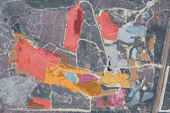
Site Layout Planning
Optimize Your Site Layout: Maximize the potential of your mining site with up to date drone images and elevation models.
Hazard Assessment: Prioritize safety with accurate plans and high risk areas.
Water and Drainage Management: Enhance your water and drainage strategies with detailed insights into surface water flow patterns.